We hired a car and headed 4 hours south to Lone Pine. The drive made us realise how much space there is in the USA - towns are spread out with lots of flat land in between which could be built on. The flat valley, which we entered as we got closer, was surrounded by impressive mountains on both sides. Finally we arrived in Lone Pine and headed for the visitor centre to get the latest information on the trail. Unfortunately the ladies behind the desk could only tell us the weather forecast, issue our free permit and sell us a map! However the lady at the outdoors shop gave us a bit more information, whilst we were hiring our snowshoes.
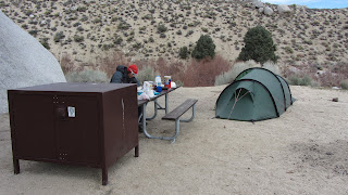
We had already stocked up on food, so we headed up Whitney Portal Road to the campsite and got our first proper look at Mount Whitney. The campsite had only opened a few days earlier, so it was pretty empty. In fact we were so early in the season, the road to the trail head was officially closed. However we saw some other cars driving and decided to try driving up to the start of the trail the night before we hiked. We were glad we did because the snow was gone (although rocks were strewn across the road) and we saved ourselves 3 miles hiking on the tarmac.
We got an early night, so that we could get an alpine start. An alpine start involves getting up in the middle of the night and start hiking in the dark. So we set off at 5am with our head torches on and started climbing up the switch backs. The first few miles were a steady climb uphill on a rocky/muddy path with the odd patch of ice covering our route. Then as the sun came up we reached the snow line. The snow was pretty hard packed so we didn't need our snowshoes (in fact we carried them all the way up and down without using them!). The impressive mountains came into view as we scrambled over rocks and wound our way through the forest.
The area flattened a little as we passed through Bighorn Park, crossed Lone Pine creek, passed through Outpost Camp and arrived at pretty Mirror Lake. Then we started climbing again through the snow and into the alpine environment. Route finding became a little trickier here but we managed to keep on track and rewarded ourselves with a snack break. The sky was blue by now, there was barely a puff of wind and it was shaping up to be a perfect weather day.
After we had refueled, we continued on up to Trail Camp and amazing close up views of Mount Whitney. The snow ramp that we had to climb also came into view and we knew it would be a challenge. So we put on our crampons, got out our ice axes and started plodding up the steep slope. We had been making good time until that point, but we slowed right down and it took us a few hours to reach the ridge at the top of the slope. We were exhausted and took lots of breaks!
Once we reached the ridge, we were very glad to see the sign saying Trail Crest. This meant 8miles completed and 3 miles to go until the summit. The view of the surrounding mountains when you reach the crest is spectacular and you get to appreciate it as you traverse across the ridge. As you travel along for the next couple of miles, you neither gain or lose much height. However the are a couple of narrow patches where an ice axe is needed to keep you balanced. We left our bags behind a rock just after the Trail Crest sign so we felt much lighter.
Finally you reach the final rocky/snowy climb up to the summit, which seemed to go on forever. By this point we were running out of energy fast, but thankfully remained completely unaffected by the high altitude. It was a relief to reach the summit hut (which was filled with snow!) and stand on the top. By this point we had been hiking for 10 hours! The wind started to pick up, so we enjoyed the stunning view, took a few pictures and headed down.
The return route was the same as the way up - but quicker! The snow ramp was particularly fast as we slid down on our crampons. Then we took a slightly different route after Trail Camp and were rewarded with views of Consultation Lake. We also saw a wild animal - maybe a coyote or a wolf.
Unfortunately we ran out of daylight just as we reached Bighorn Park and had to find our way through the trees in the dark. There were several confusing footsteps in the snow and we ended up a little lost. A bit of back tracking and following our instincts led us back to the right path, but by now it was pitch black and we had wasted an hour.
Fueled by sweets and a desire to finish, we plodded on down the switchbacks. The never ending paths finally ended - after 17 hours of hiking! We were exhausted and our feet ached, but we were very pleased to have conquered Mount Whitney!
A lie in the next day, then it was back to Lake Tahoe for one last night and a last googbye to the lake. Finally it was time to leave the USA, so we headed for Reno to catch our flight. Reno is a strange place - full of casinos, giant hotels and people sat at slot machines. We were glad it was only one night in Reno, but we were sad to leave the USA.


No comments:
Post a Comment